
Start the InstantAtlas Publisher. On the ‘Choose a Template’ screen choose one of the templates mentioned above. Click ‘Next’. On the ‘Choose Your Base Geography’ screen browse to the digital map file which you would like to see as your first base geography. This is the geography that will be displayed on opening the report. Then click the ‘Add’ Button in the bottom right corner of the screen.
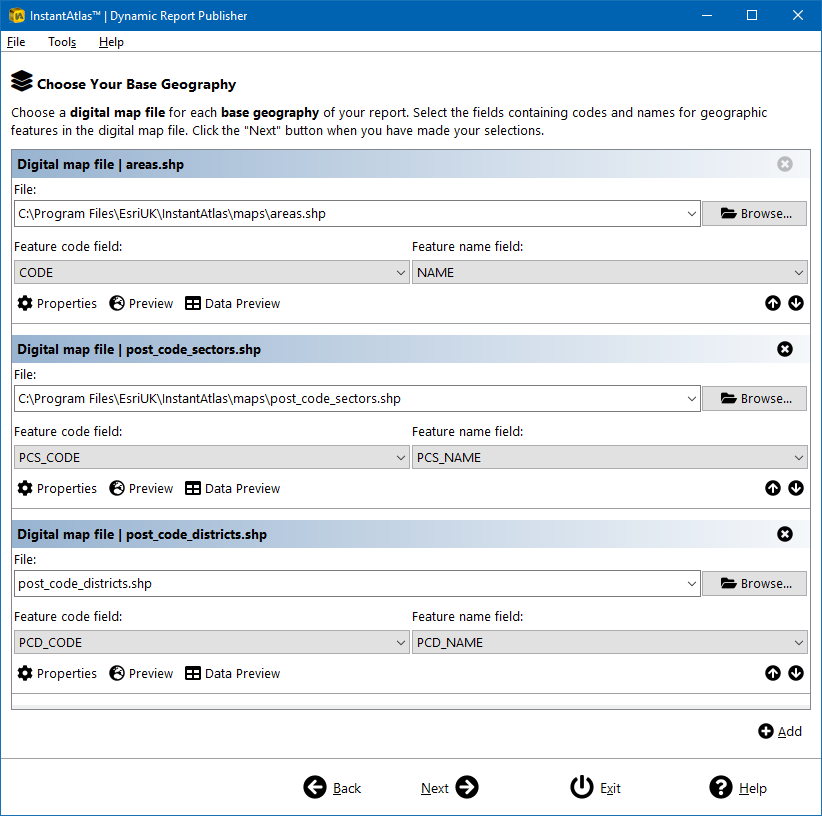
A section to choose an additional base geography will appear. For all templates except the Double Map Time Series and the Double Base Layer templates you can add up to 10 base geographies. Make sure that you add them vertically in the same order as you would like them to appear in the ‘Geography’ menu of your report. The screen shot below shows an example with three different base geographies. Make sure that geographic feature codes are unique across all of the base geographies included.
For the Double Map Time Series template two base geographies is the maximum. The upper geography will show in the top map and the lower geography will show in the bottom map.
For the Double Base Layer template you can also only add a maximum of two base geographies. If you are wanting to map points over polygons please ensure you are adding the polygon layer first and the point layer second as otherwise the points will be hidden behind the polygons in the final map.
Once you have added the base geography layers you want to use in your report, click ‘Next’. Then follow the Publisher wizard through the remaining steps of the publishing process. Note that any contextual geographies and background mapping layers you choose will be available for all the base geographies you have included – they are not base geography specific.